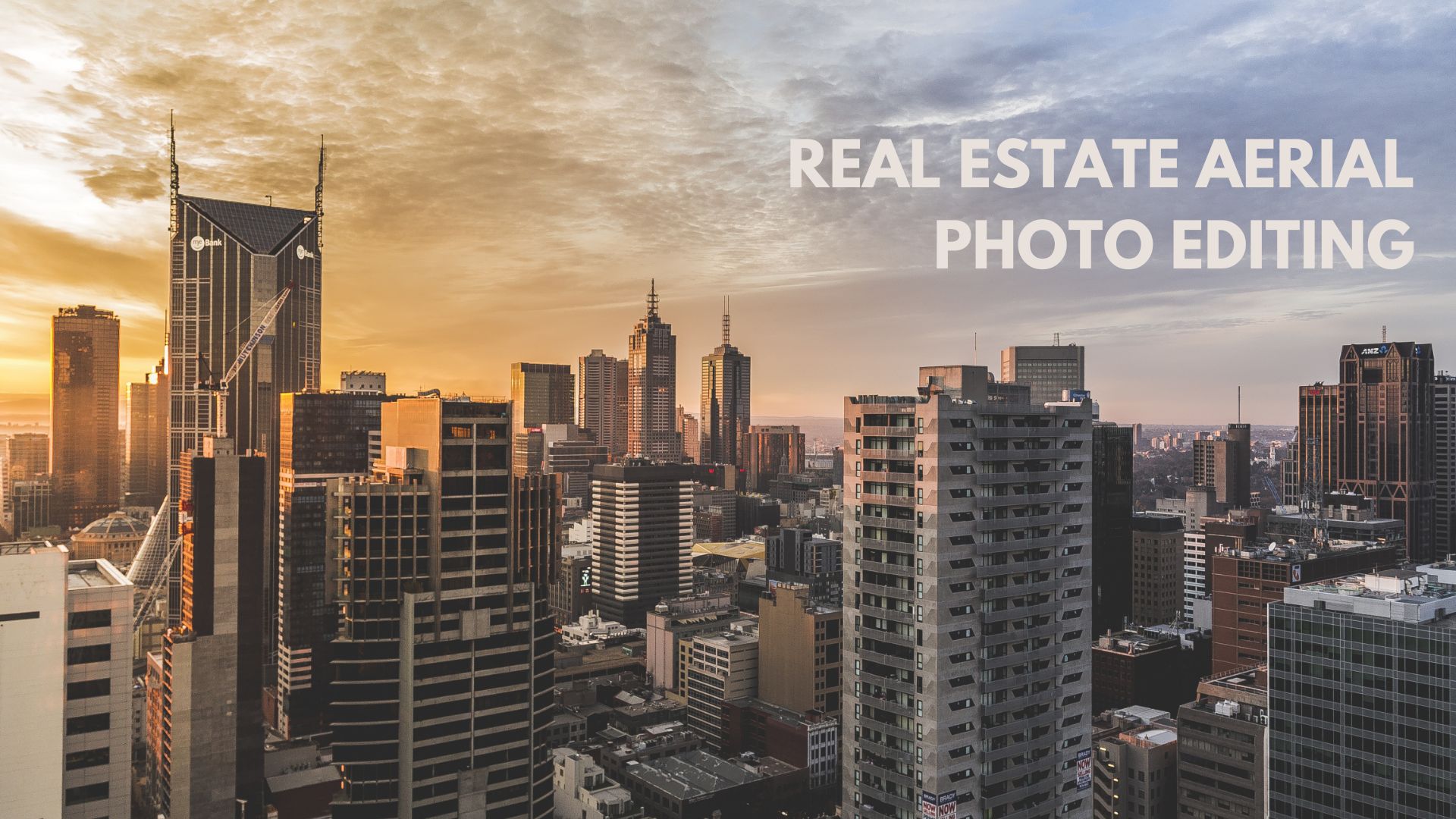
This guide walks you through everything you need to know, from why aerial editing matters to the precise techniques that transform a good drone shot into a listing magnet.
Why Aerial Photography Has Changed the Real Estate Game
Drone technology made aerial photography accessible to virtually every real estate professional. What was once reserved for luxury estates and commercial developments is now standard practice across all property segments: residential, commercial, land, and mixed-use developments.
Aerial images offer something ground-level photos simply cannot: context. They show the property’s relationship to its surroundings- proximity to parks, waterfronts, highways, schools, or the general neighborhood layout. For developers and colonizers especially, this bird’s-eye perspective communicates project scale and location advantage with compelling clarity.
However, raw drone photos rarely look magazine-worthy straight out of the camera. Weather conditions, harsh sunlight, lens distortion, hazy skies, and cluttered surroundings can all compromise the quality of even professionally captured shots. That’s where post-editing steps in to close the gap between what the camera captures and what the buyer actually sees.
What Real Estate Aerial Photo Editing Actually Involves
Many agents assume aerial editing is simply “brightening up” a photo. In reality, it’s a layered process that requires both technical skill and a strong eye for composition. Here’s what a professional editing workflow typically covers:
1. Sky Replacement and Enhancement
A flat, overcast sky instantly kills the mood of an aerial shot. Professional editors replace dull skies with vibrant blue skies or dramatic golden-hour backdrops. This single edit can completely transform how a property feels- inviting versus gloomy, premium versus ordinary.
2. Color Correction and White Balance
Drone cameras often struggle with color accuracy, especially during high-contrast midday shoots. Correcting white balance, adjusting color temperature, and boosting saturation in the right areas, greens in the lawn, blues in the pool, makes the image feel natural yet polished.
3. Exposure and Contrast Balancing
Aerial shots frequently deal with blown-out highlights (rooftops in full sun) or underexposed shadows (tree-covered driveways). Editors use exposure blending and HDR techniques to balance these extremes, ensuring every detail of the property is visible and well-lit.
4. Object and Distraction Removal
Parked cars, construction debris, power lines, neighbors’ clutter, seasonal dead patches in the lawn, these are all distractions that reduce a listing’s perceived value. Skilled editors remove or minimize them without making the result look artificially staged.
5. Lens Distortion and Perspective Correction
Wide-angle drone lenses introduce barrel distortion that makes straight lines, rooflines, fence lines, driveways, appear curved. Correcting this gives the image a more professional, architectural feel that buyers and investors instinctively trust more.
6. Lawn and Landscaping Enhancement
Seasonal browning, patchy grass, or bare garden beds can hurt a listing’s curb appeal even in an aerial view. Editors can digitally green the lawn, add or enhance greenery, and improve the overall landscaping appearance to showcase the property at its best.
7. Twilight and Virtual Staging Conversions
A daytime aerial can be converted into a stunning twilight scene, with warm interior lights glowing from windows and a deep blue sky overhead. This effect is consistently one of the highest-performing visual treatments in real estate marketing.
Read Also- Drone Video Editing for Real Estate: Tips to Make Aerial Footage Look Cinematic
Real Estate Aerial Photo Editing for Different Property Types
Not every property requires the same editing approach. Understanding what works best for each segment helps you brief your editing partner more effectively- or know what to expect when outsourcing.
Residential Properties
For single-family homes, the focus is on curb appeal- lush lawns, clean driveways, attractive neighborhood surroundings, and inviting sky conditions. Edits should feel realistic and aspirational without crossing into fantasy.
Luxury Estates and Villas
High-end properties demand a higher visual standard. Twilight conversions, pool reflections, immaculate landscaping, and even adding virtual fire to outdoor fireplaces are all fair game. The goal is to evoke lifestyle, not just showcase square footage.
Commercial Real Estate
For offices, retail complexes, and industrial spaces, editors often emphasize access roads, parking infrastructure, and proximity to transportation hubs. Signage clarity and accurate color representation of branded elements are priorities here.
Land and Development Projects
Colonizers and developers selling plots or phases of a development benefit enormously from aerial editing that clarifies property boundaries, shows site progress, and communicates planned layouts through overlay graphics or annotation editing.
Choosing the Right Real Estate Aerial Photo Editing Services
The market for Real Estate Aerial Photo Editing Services has grown substantially, and not all providers offer the same quality, turnaround time, or pricing structure. Here’s what to look for when evaluating your options:
- Turnaround Time: In a competitive market, waiting 5-7 days for edited photos costs you listing momentum. Look for services that offer 24–48 hour delivery as their standard, not their premium tier.
- Revision Policy: A reliable provider will include at least one or two rounds of revisions in their base price. This ensures the final output actually matches your vision.
- Specialization in Real Estate: General photo editors may not understand the specific needs of property marketing- legal sky replacement standards, realistic lawn enhancement, or how to handle photo manipulation disclosures. Real estate-focused providers know these nuances.
- Portfolio Consistency: Don’t just look at the best examples in their gallery. Look at the range. Consistent quality across varied property types is the better signal of a dependable partner.
- Format Compatibility: Your editing service should be able to handle RAW files, deliver in multiple formats (JPEG, PNG, TIFF), and size outputs for both MLS platforms and social media with no extra friction.
Working with a dedicated Real Estate Aerial Photo Editing Company rather than a freelancer often provides more scalability- especially for agencies handling high listing volumes or developers managing multiple phases of a project simultaneously.
Common Mistakes to Avoid in Aerial Photo Editing
Even with a great editing team, the wrong brief or unrealistic expectations can lead to results that hurt rather than help your listing. Watch out for these frequent pitfalls:
- Over-editing: Hyper-saturated colors, unnaturally perfect skies, and digitally perfect lawns can actually raise red flags for buyers who’ve learned to spot heavily manipulated listing photos.
- Inconsistency Across Shots: Aerial images should match the color temperature and overall tone of your interior and exterior ground-level photos. Inconsistency breaks immersion and undermines trust.
- Ignoring Disclosure Requirements: In many markets, significant digital alterations – like removing power lines, adding green lawns where none exist, or replacing skies – may require disclosure. Always consult local real estate regulations before publishing edited images.
- Poor Brief Communication: Providing edited reference examples and specific written instructions dramatically reduces back-and-forth. A vague “make it look better” request produces mediocre results.
Read Also- 10 Benefits of Professional Real Estate Aerial Photo Editing
The ROI of Professional Aerial Editing
If you’re weighing the cost of professional Real Estate Aerial Image Editing Services against the potential return, consider the math. Listings with high-quality photography, including professionally edited aerial shots, consistently sell faster and at higher price points than comparable listings with average visuals.
For property developers and colonizers managing large inventories, the impact compounds. A well-edited aerial image used across brochures, hoardings, digital ads, and listing portals creates a unified, premium brand impression that justifies higher asking prices and builds developer credibility over time.
The editing investment is rarely the constraint. The missed sale from underwhelming photography almost always costs more.
Building a Workflow That Scales
If you’re managing multiple listings or projects simultaneously, ad-hoc aerial editing quickly becomes a bottleneck. Building a repeatable workflow makes the process faster and the output more consistent:
- Shoot with editing in mind. Brief your drone operator on the angles, times of day, and specific coverage areas that best serve your editing needs. RAW format is non-negotiable for quality edits.
- Create an editing style guide. Define your preferred sky types, color temperature ranges, and enhancement levels. Share this with your editing partner as a standing reference.
- Use a project management system. Even a simple shared folder structure with clear naming conventions prevents miscommunication and lost files when multiple listings are in play at once.
- Build in a QA step. Before images go live, someone on your team should review against your style guide and listing standards. Don’t assume the editing service’s output is automatically publication-ready.
Conclusion
The gap between a property that generates clicks and one that gets scrolled past often comes down to image quality and aerial photos are where that gap is most visible. Investing in professional Real Estate Aerial Photo Editing isn’t a luxury for premium listings alone; it’s a competitive baseline for any agent, dealer, or developer who wants to be taken seriously in today’s visually driven market.
Whether you handle editing in-house, work with a specialist team, or partner with a full-service provider, the principles remain the same: accurate colors, balanced exposure, clean compositions, and enhancements that feel aspirational without tipping into the unbelievable. Get those elements right, and your listings won’t just look better, they’ll perform better.
FAQs: Real Estate Aerial Photo Editing
Q1: What is Real Estate Aerial Photo Editing, and why does it matter?
A: Real estate aerial photo editing is the process of professionally retouching and enhancing drone-captured property images to improve their visual appeal, accuracy, and marketing effectiveness. It matters because buyers form impressions within seconds of viewing listing photos, and high-quality aerial imagery directly influences perceived property value, time-on-market, and ultimately, sale price.
Q2: How long does professional aerial photo editing typically take?
A: Most professional real estate editing services deliver completed aerial edits within 24 to 48 hours for standard orders. Some providers offer same-day or rush delivery for an additional fee. If you’re working with a high-volume agency or developer account, you may be able to negotiate priority processing as part of a bulk agreement.
Q3: Is sky replacement in aerial real estate photos legal and ethical?
A: Sky replacement is widely used and generally accepted in real estate photography, as it’s considered an enhancement rather than a misrepresentation of the property itself. However, regulations vary by market and listing platform. It’s always best to check your local real estate board guidelines and MLS rules. Significant alterations that could mislead buyers about the physical property, not just the sky, are where ethical and legal lines can be crossed.
Q4: Can aerial photo editing help land and development project listings specifically?
A: Absolutely. For land parcels, development phases, and colonizer projects, aerial editing is especially powerful. Editors can clarify plot boundaries, annotate site maps, enhance surrounding infrastructure visibility, and even create before-and-after composite images that help buyers visualize future development. It’s one of the most effective visual tools available for off-plan and land sales.
Q5: How do I choose between outsourcing to a Real Estate Aerial Photo Editing Company versus hiring an in-house editor?
A: The decision typically comes down to volume and specialization. If you’re handling fewer than 10–15 listings per month, outsourcing to a dedicated company is almost always more cost-effective- you avoid salaries, software licenses, and training costs. For large agencies or development firms with consistent, high-volume needs and specific brand standards, an in-house editor can offer faster iteration and tighter brand control. Many successful agencies use a hybrid model: in-house for quick turnarounds and a specialist company for complex or high-stakes projects.